
Restr:Map of Argolis.jpg

Restr orin (5 294 × 3 756 piksel, ment ar restr : 14,26 Mio, seurt MIME : image/jpeg)
![]()
| Tennet eo ar restr-mañ eus Wikimedia Commons ha gallout a ra bezañ implijet evit raktresoù all. Diskouezet eo deskrivadur he fajenn zeskrivañ amañ dindan. |
| Deskrivadur |
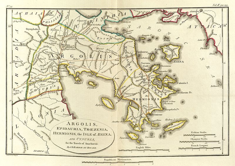
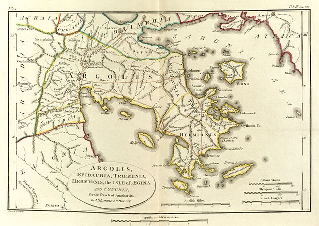
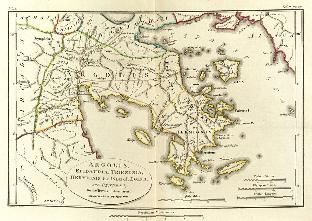
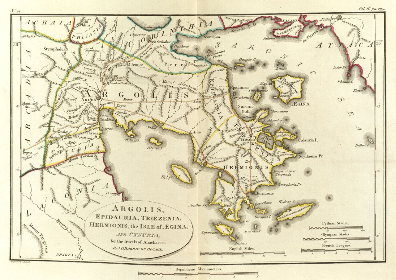
English: Scan of Map of Argolis.
|
|||||||
| Deiziad | ||||||||
| Mammenn | Maps, plans, views and coins illustrative of the travels of Anacharsis the Younger in Greece, during the middle of the fourth century before the Christian era | |||||||
| Aozer | J. J. Barthélemy | |||||||

Istor ar restr
Klikañ war un deiziad/eur da welet ar restr evel ma oa da neuze.
| Deiziad/Eur | Munud | Mentoù | Implijer | Notenn | |
|---|---|---|---|---|---|
| red | 24 Mae 2010 da 01:27 | | 5 294 × 3 756 (14,26 Mio) | Aremulus | {{Information |Description={{en|1=Scan of Map of Argolis. {{PD-1923}} {{PD-self}} {{PD-old}} {{PD-scan}}}} |Source=Maps, plans, views and coins illustrative of the travels of Anacharsis the Younger in Greece, during the middle of the fourth century befor |
Implij ar restr
Implijout a ra ar bajenn da heul ar restr-mañ :
Implij hollek ar restr
Ober a ra ar wikioù da-heul gant ar restr-mañ :
- Implij war da.wikipedia.org
- Implij war el.wikipedia.org
- Implij war en.wikipedia.org
- Argolis
- Asine
- Midea (Argolid)
- Lyrceia
- Orneae
- Mases
- Hysiae (Argolis)
- Antheia (Argolis)
- Oenoe (Argolis)
- Elaeus (Argolis)
- Eion (Argolis)
- Cenchreae (Argolis)
- Mount Phoukas
- Neris (Cynuria)
- Eva (Cynuria)
- Araethyrea (Argolis)
- Sphaeria
- Genesium
- Apobathmi
- Lessa (Argolis)
- Prosymna
- Temenium
- Template:AncientArgolis-geo-stub
- Implij war it.wikipedia.org
- Implij war ka.wikipedia.org
- Implij war la.wikipedia.org
- Implij war lv.wikipedia.org
- Implij war mk.wikipedia.org
- Implij war sco.wikipedia.org
- Implij war sl.wikipedia.org
- Implij war www.wikidata.org