
Restr:PeriplusAncientMap.jpg
Ment ar rakweled-mañ : 763 × 600 piksel. pizhderioù all : 305 × 240 piksel | 611 × 480 piksel | 977 × 768 piksel | 1 280 × 1 006 piksel | 1 524 × 1 198 piksel.
Restr orin (1 524 × 1 198 piksel, ment ar restr : 239 Kio, seurt MIME : image/jpeg)
![]()
| Tennet eo ar restr-mañ eus Wikimedia Commons ha gallout a ra bezañ implijet evit raktresoù all. Diskouezet eo deskrivadur he fajenn zeskrivañ amañ dindan. |
Diverradur
| Deskrivadur |
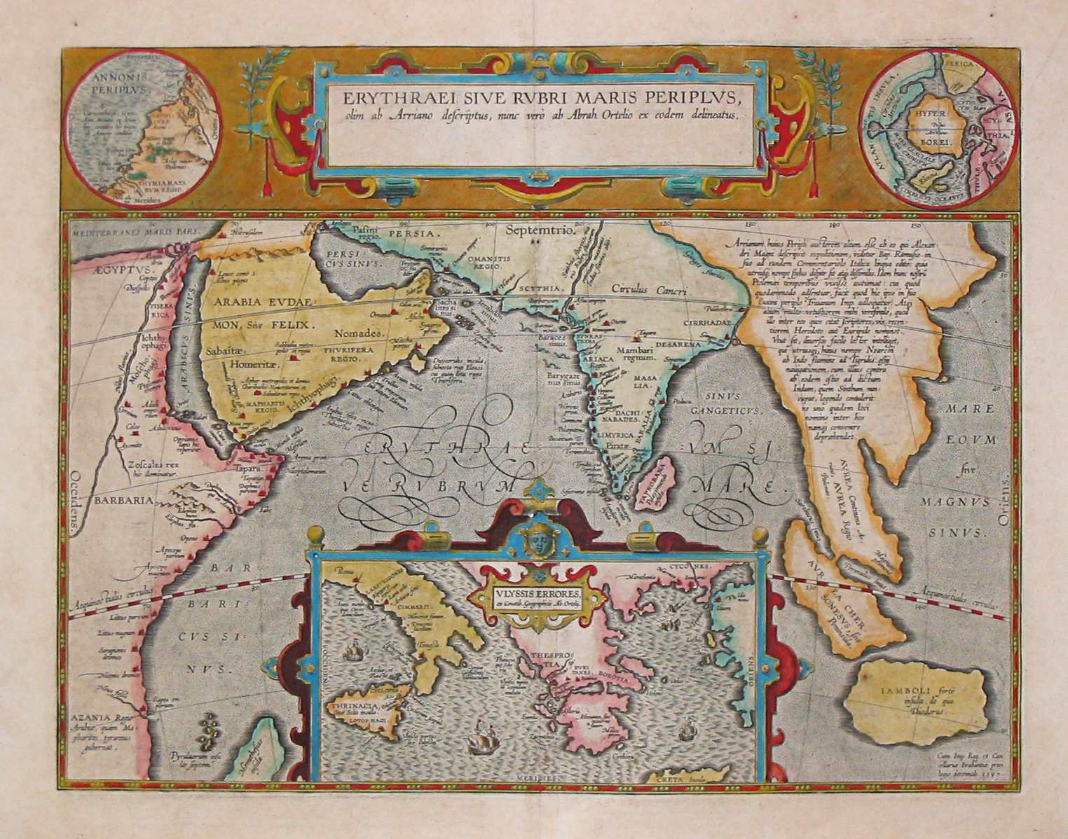
English: Map by Abraham Ortelius, (1527-1598) for the Periplus Maris Erythraei (Περίπλους τὴς Ἐρυθράς Θαλάσσης "Periplus of the Erythraean Sea"), attributed to Arrian. |
|||||||||||||||||||||||
| Deiziad | ||||||||||||||||||||||||
| Mammenn | Plate [162] from: Theatrum orbus terrarum / Abraham Ortelius. Antverpiae: Apud Ioannem Bapt. Vrintium, 1609. | |||||||||||||||||||||||
| Aozer |
|
|||||||||||||||||||||||

See also:
Aotre-implijout
|
This is a faithful photographic reproduction of a two-dimensional, public domain work of art. The work of art itself is in the public domain for the following reason:
The official position taken by the Wikimedia Foundation is that "faithful reproductions of two-dimensional public domain works of art are public domain".
This photographic reproduction is therefore also considered to be in the public domain in the United States. In other jurisdictions, re-use of this content may be restricted; see Reuse of PD-Art photographs for details. | ||||
Istor ar restr
Klikañ war un deiziad/eur da welet ar restr evel ma oa da neuze.
| Deiziad/Eur | Munud | Mentoù | Implijer | Notenn | |
|---|---|---|---|---|---|
| red | 24 Meu 2007 da 08:10 | | 1 524 × 1 198 (239 Kio) | World Imaging | Ancient map (17th century) depicting the locations of the Periplus of the Erythraean Sea. |
Implij ar restr
Implijout a ra ar bajenn da heul ar restr-mañ :
Implij hollek ar restr
Ober a ra ar wikioù da-heul gant ar restr-mañ :
- Implij war ar.wikipedia.org
- Implij war as.wikipedia.org
- Implij war bn.wikipedia.org
- Implij war ca.wikipedia.org
- Implij war cs.wikipedia.org
- Implij war de.wikipedia.org
- Implij war el.wikipedia.org
- Implij war en.wikipedia.org
- Implij war es.wikipedia.org
- Implij war fa.wikipedia.org
- Implij war fa.wikibooks.org
- Implij war fr.wikipedia.org
- Implij war he.wikipedia.org
- Implij war hif.wikipedia.org
- Implij war hi.wikipedia.org
- Implij war hr.wikipedia.org
- Implij war hu.wikipedia.org
- Implij war ilo.wikipedia.org
- Implij war it.wikipedia.org
- Implij war ja.wikipedia.org
- Implij war la.wikipedia.org
- Implij war no.wikipedia.org
- Implij war oc.wikipedia.org
- Implij war or.wikipedia.org
- Implij war pnb.wikipedia.org
- Implij war ru.wikipedia.org
- Implij war sd.wikipedia.org
- Implij war sh.wikipedia.org
- Implij war simple.wikipedia.org
- Implij war sl.wikipedia.org
Gwelet muioc'h eus implij hollek ar restr-mañ.