
Restr:Frontiers of France (1521).jpg
Ment ar rakweled-mañ : 460 × 599 piksel. pizhderioù all : 184 × 240 piksel | 368 × 480 piksel | 590 × 768 piksel | 786 × 1 024 piksel | 1 680 × 2 188 piksel.
Restr orin (1 680 × 2 188 piksel, ment ar restr : 1,32 Mio, seurt MIME : image/jpeg)
![]()
| Tennet eo ar restr-mañ eus Wikimedia Commons ha gallout a ra bezañ implijet evit raktresoù all. Diskouezet eo deskrivadur he fajenn zeskrivañ amañ dindan. |
.jpg)
Diverradur
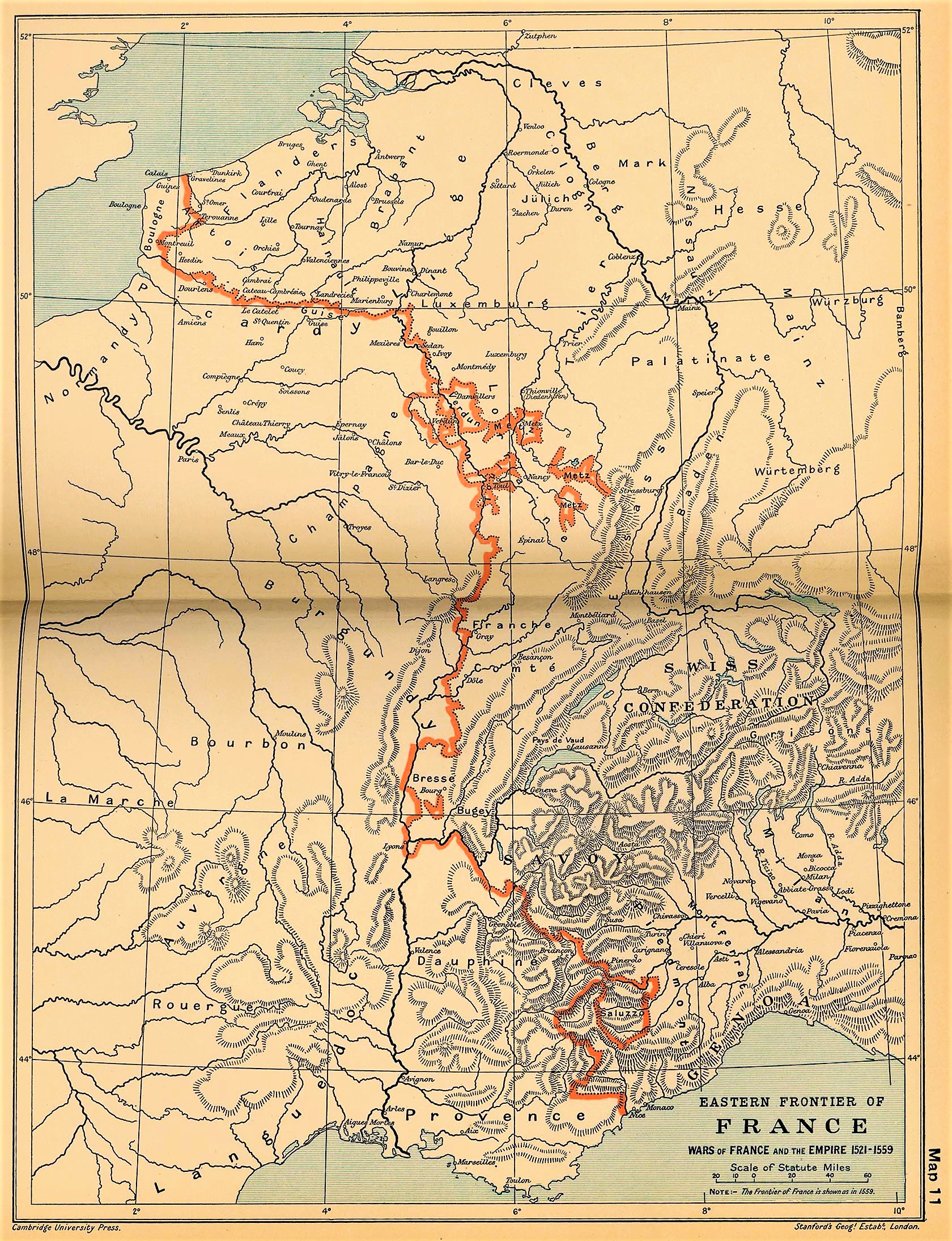
| Deskrivadur | Eastern frontiers of France for the period 1521–59; line shown is the 1559 border. | |||||
| Deiziad | ||||||
| Mammenn | The Cambridge Modern History Atlas (1912) via the Perry-Castañeda Library Map Collection at the University of Texas. | |||||
| Aozer | Sir Adolphus William Ward, G.W. Prothero, Sir Stanley Mordaunt Leathes, and E.A. Benians (eds.) | |||||
| Aotre (Adimplij ar restr-mañ) |
|
|||||
Istor ar restr
Klikañ war un deiziad/eur da welet ar restr evel ma oa da neuze.
| Deiziad/Eur | Munud | Mentoù | Implijer | Notenn | |
|---|---|---|---|---|---|
| red | 1 Kzu 2021 da 14:51 | | 1 680 × 2 188 (1,32 Mio) | Amitchell125 | quality enhanced slightly |
| 1 Kzu 2021 da 14:47 |  | 561 × 502 (200 Kio) | Amitchell125 | quality enhanced slightly | |
| 19 Mez 2006 da 06:21 |  | 1 680 × 2 188 (767 Kio) | Kirill Lokshin | {{Information |Description= Frontiers of France in 1521. |Source= ''The Cambridge Modern History Atlas'' (1912) via the [http://www.lib.utexas.edu/maps/historical/ward_1912.html Perry-Castañeda Library Map Collection at the University of Texas]. |Date= 1 |
Implij ar restr
Pajenn ebet ne implij ar restr-mañ.
Implij hollek ar restr
Ober a ra ar wikioù da-heul gant ar restr-mañ :
- Implij war ast.wikipedia.org
- Implij war bg.wikipedia.org
- Implij war ca.wikipedia.org
- Implij war es.wikipedia.org
- Implij war fr.wikipedia.org
- Implij war it.wikipedia.org
- Implij war ja.wikipedia.org
- Implij war nl.wikipedia.org
- Implij war pt.wikipedia.org
- Implij war tr.wikipedia.org
.jpg)