
Restr:Sulphur Tornado Radar Image.png
Ment ar rakweled-mañ : 800 × 394 piksel. pizhderioù all : 320 × 158 piksel | 640 × 315 piksel | 1 024 × 505 piksel | 1 280 × 631 piksel | 2 322 × 1 144 piksel.
Restr orin (2 322 × 1 144 piksel, ment ar restr : 5,03 Mio, seurt MIME : image/png)
![]()
| Tennet eo ar restr-mañ eus Wikimedia Commons ha gallout a ra bezañ implijet evit raktresoù all. Diskouezet eo deskrivadur he fajenn zeskrivañ amañ dindan. |
Diverradur
| Deskrivadur |
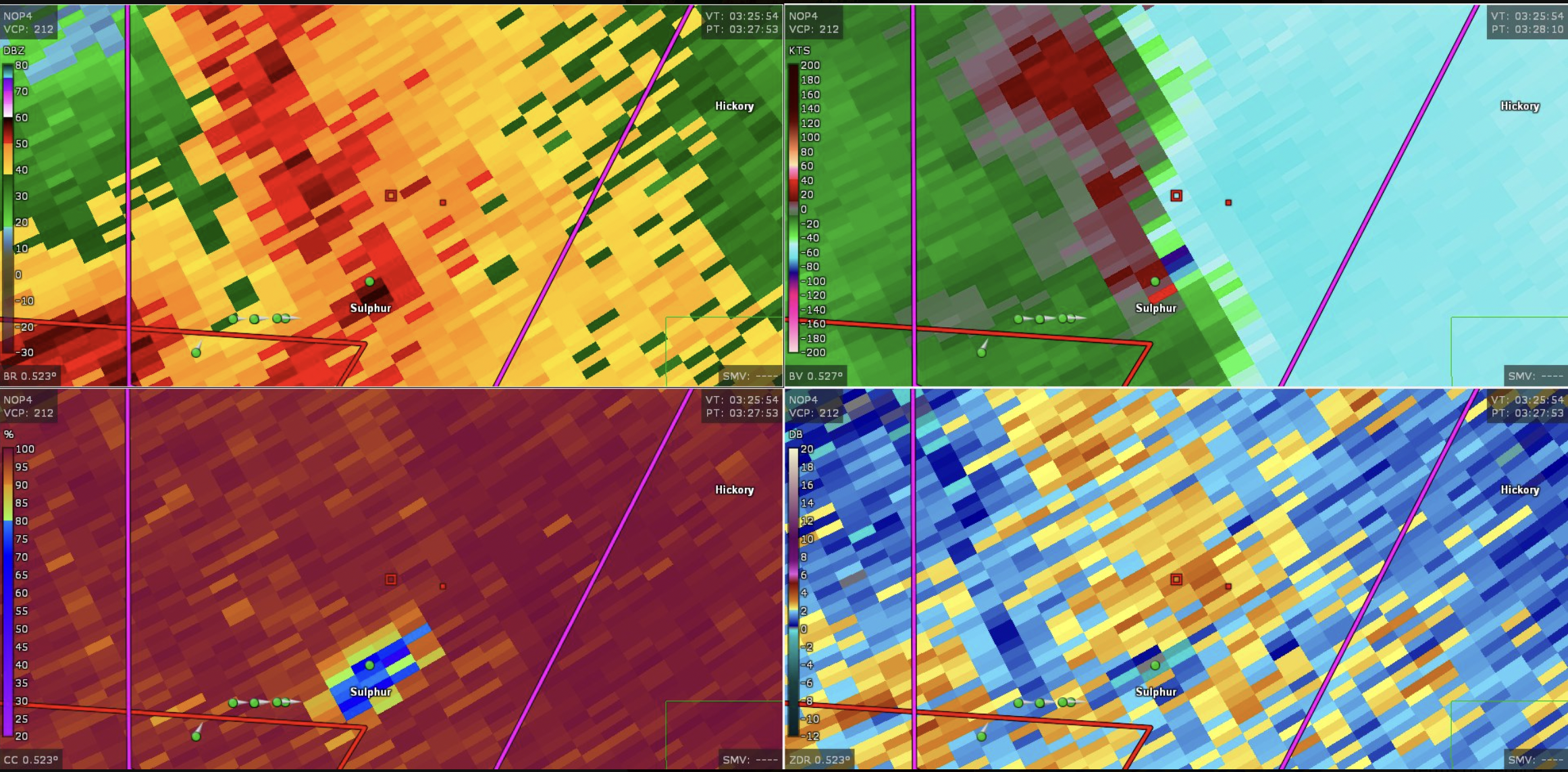
English: This image shows the radar presentation of a damaging tornado in Sulphu,r Oklahoma on April 27, 2024. |
| Deiziad | |
| Mammenn | NEXRAD |
| Aozer | National Weather Service, Federal Aviation Administration, United States Air Force |
Aotre-implijout
This image is in the public domain because it is from one or more of the U.S. government’s 159 NEXRAD radars, which are jointly owned and operated by the National Weather Service (NWS), an agency of the National Oceanic and Atmospheric Administration (NOAA) within the United States Department of Commerce, the Federal Aviation Administration (FAA) within the Department of Transportation, and the U.S. Air Force within the Department of Defense.
Thus all NEXRAD images are public domain.
|
  |
Istor ar restr
Klikañ war un deiziad/eur da welet ar restr evel ma oa da neuze.
| Deiziad/Eur | Munud | Mentoù | Implijer | Notenn | |
|---|---|---|---|---|---|
| red | 28 Ebr 2024 da 19:44 | | 2 322 × 1 144 (5,03 Mio) | Floriangkmcc | Uploaded a work by The National Weather Service from Nexrad Radar with UploadWizard |
Implij ar restr
Pajenn ebet ne implij ar restr-mañ.