
Restr:Xinjiang Internment Map, US-Aus Gov Assessment.jpg
Ment ar rakweled-mañ : 800 × 495 piksel. pizhderioù all : 320 × 198 piksel | 640 × 396 piksel | 1 024 × 634 piksel | 1 280 × 792 piksel | 2 048 × 1 267 piksel.
Restr orin (2 048 × 1 267 piksel, ment ar restr : 150 Kio, seurt MIME : image/jpeg)
![]()
| Tennet eo ar restr-mañ eus Wikimedia Commons ha gallout a ra bezañ implijet evit raktresoù all. Diskouezet eo deskrivadur he fajenn zeskrivañ amañ dindan. |
Diverradur
| Deskrivadur |
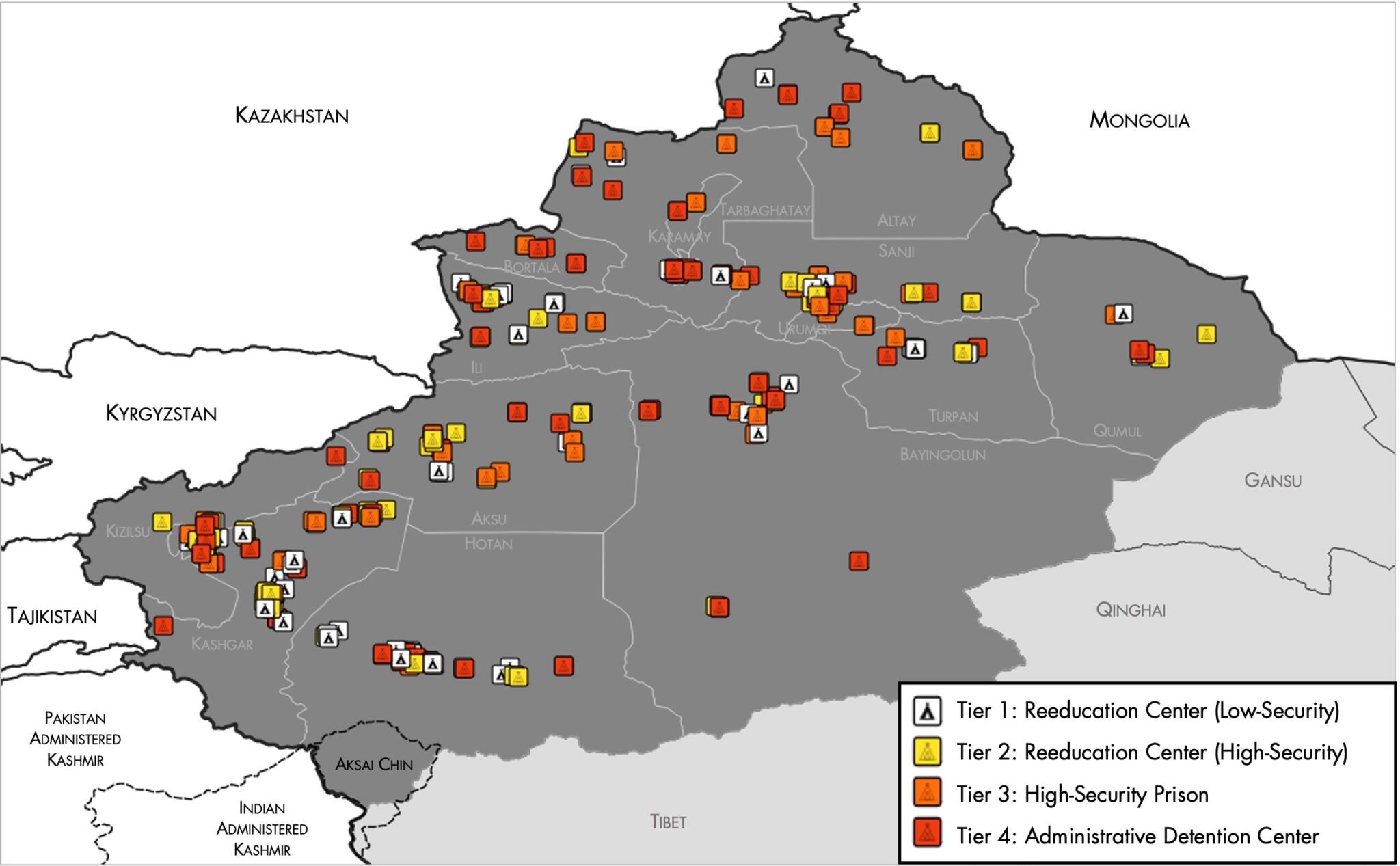
English: Map of the Xinjiang Internment Camps created by the RAND Corporation based on data collected by the US National Geospatial Intelligence Agency and the Australian Strategic Policy Institute. Open source here. |
||||||||
| Deiziad | |||||||||
| Mammenn | https://www.tearline.mil/public_page/xinjiang-nighttime-1/ | ||||||||
| Aozer | National Geospatial Intelligence Agency, using data from the Australian Strategic Policy Institute, and administrative boundaries from GADM. | ||||||||
| Aotre (Adimplij ar restr-mañ) |
|


Istor ar restr
Klikañ war un deiziad/eur da welet ar restr evel ma oa da neuze.
| Deiziad/Eur | Munud | Mentoù | Implijer | Notenn | |
|---|---|---|---|---|---|
| red | 2 Mae 2021 da 05:05 | | 2 048 × 1 267 (150 Kio) | Abovfold | Uploaded a work by {{w|National Geospatial Intelligence Agency}}, using data from the {{w|Australian Strategic Policy Institute}}, and administrative boundaries from {{w|GADM}}. from https://www.tearline.mil/public_page/xinjiang-nighttime-1/ with UploadWizard |
Implij ar restr
Implijout a ra ar bajenn da heul ar restr-mañ :
Implij hollek ar restr
Ober a ra ar wikioù da-heul gant ar restr-mañ :
- Implij war ba.wikipedia.org
- Implij war cs.wikipedia.org
- Implij war de.wikipedia.org
- Implij war el.wikipedia.org
- Implij war en.wikipedia.org
- Implij war es.wikipedia.org
- Implij war fi.wikipedia.org
- Implij war fr.wikipedia.org
- Implij war ga.wikipedia.org
- Implij war he.wikipedia.org
- Implij war km.wikipedia.org
- Implij war nl.wikipedia.org
- Implij war or.wikipedia.org
- Implij war pl.wikipedia.org
- Implij war pt.wikipedia.org
- Implij war ru.wikinews.org
- Implij war sv.wikipedia.org
- Implij war szl.wikipedia.org
- Implij war tr.wikipedia.org
- Implij war www.wikidata.org