
Restr:Ross and Cromarty UK location map.svg

Ment rakwel PNG ar restr SVG : 610 × 599 piksel. pizhderioù all : 244 × 240 piksel | 489 × 480 piksel | 782 × 768 piksel | 1 042 × 1 024 piksel | 2 085 × 2 048 piksel | 1 425 × 1 400 piksel.
Restr orin (restr SVG file, pizhder 1 425 × 1 400 piksel, ment ar restr : 3,04 Mio)
![]()
| Tennet eo ar restr-mañ eus Wikimedia Commons ha gallout a ra bezañ implijet evit raktresoù all. Diskouezet eo deskrivadur he fajenn zeskrivañ amañ dindan. |
| Deskrivadur |
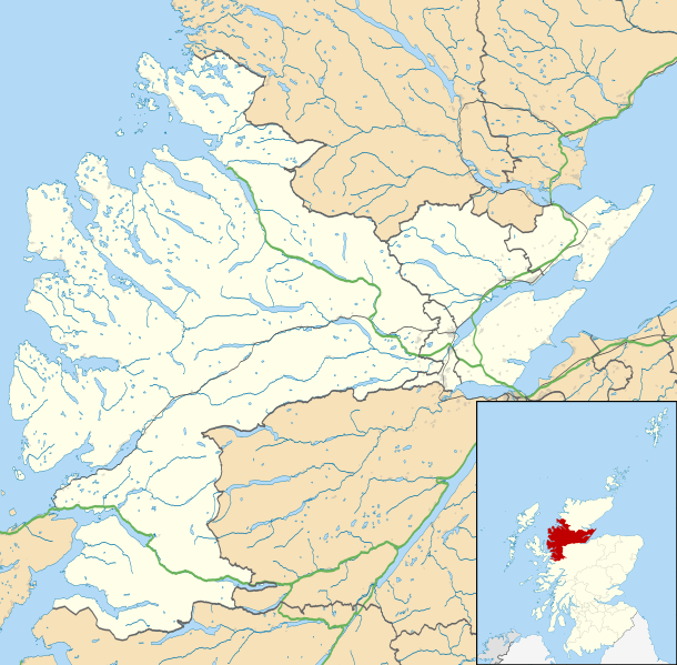
Map of Ross and Cromarty, UK in 2011, with the following information shown:
Equirectangular map projection on WGS 84 datum, with N/S stretched 180% Geographic limits:
|
| Deiziad | |
| Mammenn |
|
| Aozer | Nilfanion, created using Ordnance Survey data |
| Aotre (Adimplij ar restr-mañ) |
Emañ ar restr-mañ dindan an aotre-implijout Creative Commons Deroadenn-Kenrannañ 3.0 Unported Deroadenn: Contains Ordnance Survey data © Crown copyright and database right
|
| Stummoù all | File:Ross and Cromarty UK blank map.svg - Blank map |
Istor ar restr
Klikañ war un deiziad/eur da welet ar restr evel ma oa da neuze.
| Deiziad/Eur | Munud | Mentoù | Implijer | Notenn | |
|---|---|---|---|---|---|
| red | 4 Meu 2011 da 23:31 | | 1 425 × 1 400 (3,04 Mio) | Nilfanion | {{Information |Description=Map of Ross and Cromarty, UK in 2011, with the following information shown: *Ward boundaries *Coastline and lakes *Roads and railways *Urban areas Equirectangular map projection on WGS 84 datum, with N/S |
Implij ar restr
Implijout a ra ar bajenn da heul ar restr-mañ :
Implij hollek ar restr
Ober a ra ar wikioù da-heul gant ar restr-mañ :
- Implij war ar.wikipedia.org
- Implij war be.wikipedia.org
- Implij war ceb.wikipedia.org
- Implij war en.wikipedia.org
- Achduart
- Achiltibuie
- Cromarty
- Gairloch
- Ullapool
- Dingwall
- Fortrose
- Kyle of Lochalsh
- Lochcarron
- Culbokie
- Portmahomack
- Hill of Fearn
- Strathpeffer
- Loch Kishorn
- Glenelg, Highland
- Saltburn, Ross and Cromarty
- Dornie
- Invergordon
- Applecross
- Hilton of Cadboll
- Achanalt
- Achandunie
- Alness
- Rosemarkie
- Achintraid
- Ardarroch
- Evanton
- Kildary
- Jemimaville
- Shieldaig
- Kinlochewe
- Poolewe
- Scoraig
- Victoria Park, Dingwall
- Coigach
- Conon Bridge
- North Kessock
- Munlochy
- Edderton
- Duirinish, Lochalsh
- Garve
- Muir of Ord
- Corran, Loch Hourn
- Milton, Easter Ross
- HMS Fieldfare
- Maryburgh
- Nigg, Highland
Gwelet muioc'h eus implij hollek ar restr-mañ.