
Restr:Pomeraniae Ducatus Tabula.jpg

Ment ar rakweled-mañ : 764 × 600 piksel. pizhderioù all : 306 × 240 piksel | 611 × 480 piksel | 978 × 768 piksel | 1 280 × 1 005 piksel | 2 560 × 2 010 piksel | 3 009 × 2 363 piksel.
Restr orin (3 009 × 2 363 piksel, ment ar restr : 4,85 Mio, seurt MIME : image/jpeg)
![]()
| Tennet eo ar restr-mañ eus Wikimedia Commons ha gallout a ra bezañ implijet evit raktresoù all. Diskouezet eo deskrivadur he fajenn zeskrivañ amañ dindan. |
Diverradur
| Deskrivadur |
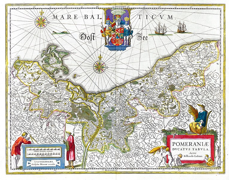
Deutsch: Karte des historischen Herzogtums Pommern aus dem 17. Jahrhundert. English: Map of the historical Duchy of Pomerania from the 17th century |
||||||||||||||||||||
| Deiziad | |||||||||||||||||||||
| Mammenn | Willem & Joan Blaeu, Atlas Blaeu (later Atlas Maior), 1662 | ||||||||||||||||||||
| Aozer |
|
||||||||||||||||||||
| Aotre (Adimplij ar restr-mañ) |
PD-Old | ||||||||||||||||||||
| Stummoù all | Pomeraniae Ducatus Tabula2.jpg | ||||||||||||||||||||

Aotre-implijout
|
This is a faithful photographic reproduction of a two-dimensional, public domain work of art. The work of art itself is in the public domain for the following reason:
The official position taken by the Wikimedia Foundation is that "faithful reproductions of two-dimensional public domain works of art are public domain".
This photographic reproduction is therefore also considered to be in the public domain in the United States. In other jurisdictions, re-use of this content may be restricted; see Reuse of PD-Art photographs for details. | ||||
Istor ar restr
Klikañ war un deiziad/eur da welet ar restr evel ma oa da neuze.
| Deiziad/Eur | Munud | Mentoù | Implijer | Notenn | |
|---|---|---|---|---|---|
| red | 26 Gwe 2018 da 08:56 | | 3 009 × 2 363 (4,85 Mio) | Gunnar.offel | * Gilb entfernt * Aufgehellt * ... |
| 16 Gwe 2005 da 18:49 |  | 3 009 × 2 363 (3,09 Mio) | Snufkin~commonswiki | Map of Western Pomerania (Duchy of Pomerania) from the 17th century. Author: Eilhardus Lubinus. |
Implij ar restr
Implijout a ra ar bajenn da heul ar restr-mañ :
Implij hollek ar restr
Ober a ra ar wikioù da-heul gant ar restr-mañ :
- Implij war ar.wikipedia.org
- Implij war ast.wikipedia.org
- Implij war be.wikipedia.org
- Implij war ca.wikipedia.org
- Implij war csb.wikipedia.org
- Implij war cs.wikipedia.org
- Implij war da.wikipedia.org
- Implij war de.wikipedia.org
- 1635
- Hinterpommern
- Siebenjähriger Krieg
- Portal:Pommern
- Geschichte Pommerns
- Schwedisch-Pommern
- Nordischer Krieg (1674–1679)
- Herzogtum Pommern
- Pommernfeldzug 1715/1716
- Eilhard Lubin
- Benutzer Diskussion:Alma/Archiv 2/2007
- Portal:Pommern/Geschichte
- Benutzer:Marcus Valerius Corvus/Nordischer Krieg
- Pommernfeldzug 1675/76
- Benutzer:Eandré/Karten
- Portal:Mecklenburg-Vorpommern/Bilderarchiv 2009
- Vertrag von Schwedt
- Wikipedia Diskussion:Hauptseite/Artikel des Tages/Archiv/Vorschläge/2016/Q2
- Wikipedia:Hauptseite/Archiv/19. April 2016
- Voigdehäger Teich
- Implij war de.wikisource.org
- Implij war el.wikipedia.org
- Implij war en.wikipedia.org
- Implij war eo.wikipedia.org
- Implij war es.wikipedia.org
Gwelet muioc'h eus implij hollek ar restr-mañ.