
Restr:Map of Xiangkhoang Province, Laos.jpg

Ment ar rakweled-mañ : 782 × 600 piksel. pizhderioù all : 313 × 240 piksel | 626 × 480 piksel | 1 001 × 768 piksel | 1 305 × 1 001 piksel.
Restr orin (1 305 × 1 001 piksel, ment ar restr : 828 Kio, seurt MIME : image/jpeg)
![]()
| Tennet eo ar restr-mañ eus Wikimedia Commons ha gallout a ra bezañ implijet evit raktresoù all. Diskouezet eo deskrivadur he fajenn zeskrivañ amañ dindan. |
Diverradur
| Deskrivadur |
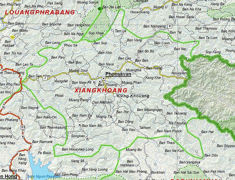
English: Map of Xiangkhoang Province, Laos. |
| Deiziad | |
| Mammenn | Based on File:UNOSAT Laos Base Map.jpg |
| Aozer | UNOSAT, United Nations, modified by Dr. Blofeld |
| Aotre (Adimplij ar restr-mañ) |
The original file is marked with the UN symbol which means that it is a public domain resource. |
Aotre-implijout
| This work is ineligible for copyright and therefore in the public domain because it consists entirely of information that is common property and contains no original authorship. |
Istor ar restr
Klikañ war un deiziad/eur da welet ar restr evel ma oa da neuze.
| Deiziad/Eur | Munud | Mentoù | Implijer | Notenn | |
|---|---|---|---|---|---|
| red | 6 Kzu 2012 da 21:10 | | 1 305 × 1 001 (828 Kio) | Blofeld Dr. | {{Information |Description ={{en|1=d}} |Source =d |Author =d |Date =d |Permission = |other_versions = }} d |
Implij ar restr
Implijout a ra ar bajenn da heul ar restr-mañ :
Implij hollek ar restr
Ober a ra ar wikioù da-heul gant ar restr-mañ :
- Implij war cs.wikipedia.org
- Implij war da.wikipedia.org
- Implij war de.wikipedia.org
- Implij war en.wikipedia.org
- Implij war es.wikipedia.org
- Implij war fa.wikipedia.org
- Implij war fr.wikipedia.org
- Implij war hr.wikipedia.org
- Implij war id.wikipedia.org
- Implij war th.wikipedia.org
- Implij war ur.wikipedia.org
- Implij war vi.wikipedia.org