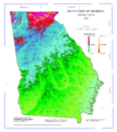
Restr:Map of Georgia elevations.png

Ment ar rakweled-mañ : 536 × 599 piksel. pizhderioù all : 215 × 240 piksel | 429 × 480 piksel | 687 × 768 piksel | 916 × 1 024 piksel | 1 832 × 2 048 piksel | 3 131 × 3 500 piksel.
Restr orin (3 131 × 3 500 piksel, ment ar restr : 1,99 Mio, seurt MIME : image/png)
Istor ar restr
Klikañ war un deiziad/eur da welet ar restr evel ma oa da neuze.
| Deiziad/Eur | Munud | Mentoù | Implijer | Notenn | |
|---|---|---|---|---|---|
| red | 26 Kzu 2011 da 14:38 |  | 3 131 × 3 500 (1,99 Mio) | File Upload Bot (Magnus Manske) | {{BotMoveToCommons|en.wikipedia|year={{subst:CURRENTYEAR}}|month={{subst:CURRENTMONTHNAME}}|day={{subst:CURRENTDAY}}}} {{Information |Description={{en|USGS map of Georgia elevations<br/> [[:en:Category:Georgia (U.S. state) ma |
Implij ar restr
Implijout a ra ar bajenn da heul ar restr-mañ :
Implij hollek ar restr
Ober a ra ar wikioù da-heul gant ar restr-mañ :
- Implij war arz.wikipedia.org
- Implij war el.wikipedia.org
- Implij war en.wikipedia.org
- Implij war eo.wikipedia.org
- Implij war ja.wikipedia.org

