
Restr:GulfofMexico3D.jpg

Ment ar rakweled-mañ : 734 × 600 piksel. pizhderioù all : 294 × 240 piksel | 588 × 480 piksel | 940 × 768 piksel | 1 253 × 1 024 piksel | 2 507 × 2 048 piksel | 3 000 × 2 451 piksel.
Restr orin (3 000 × 2 451 piksel, ment ar restr : 508 Kio, seurt MIME : image/jpeg)
![]()
| Tennet eo ar restr-mañ eus Wikimedia Commons ha gallout a ra bezañ implijet evit raktresoù all. Diskouezet eo deskrivadur he fajenn zeskrivañ amañ dindan. |
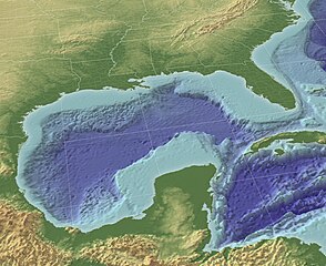
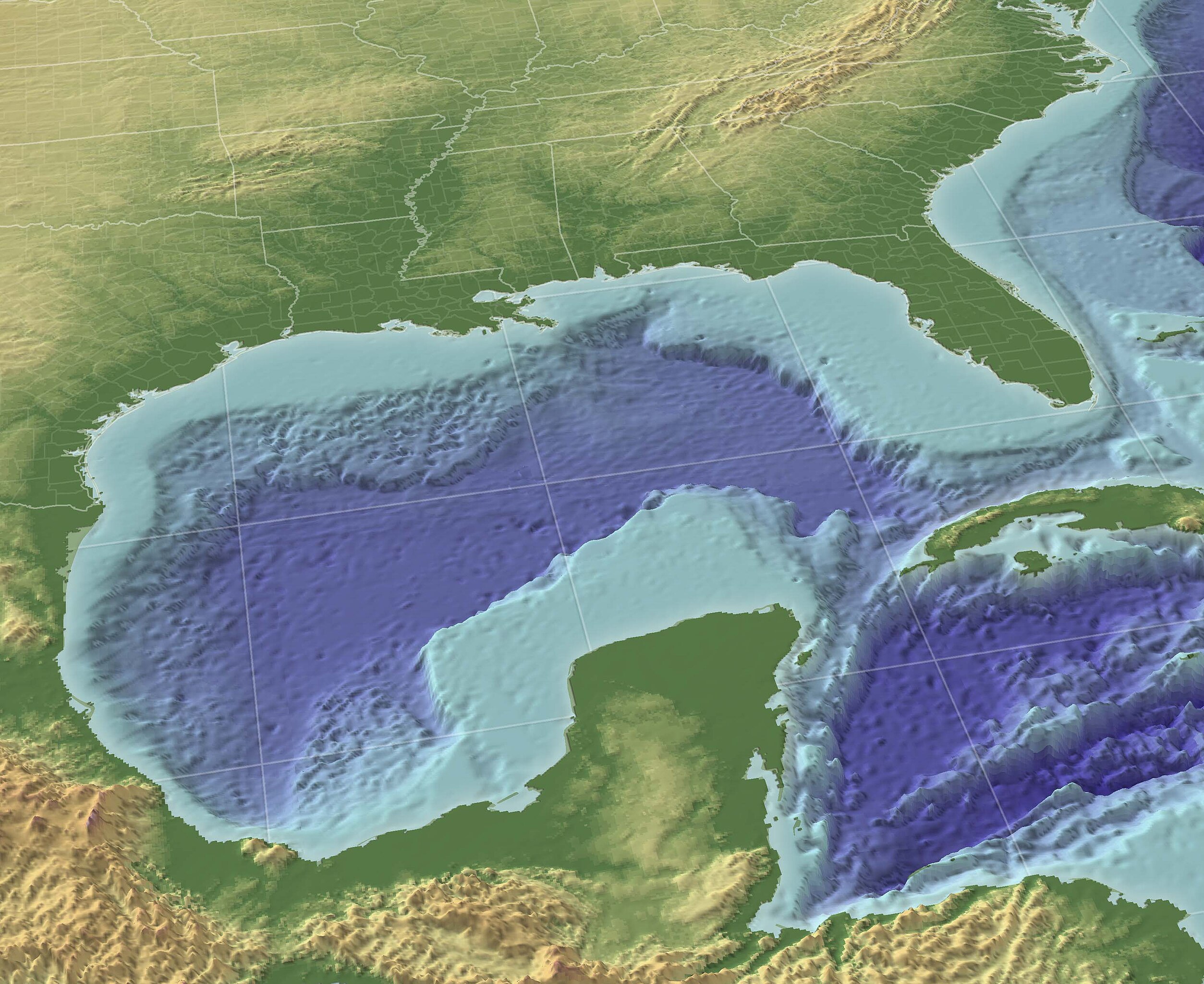
"The Gulf of Mexico in 3D perspective. A GIS can create very accurate and realistic-looking environments." Source (High-Res: 3000x2451).
This image is in the public domain because it contains materials that originally came from the U.S. National Oceanic and Atmospheric Administration, taken or made as part of an employee's official duties.
|
From English wikipedia w:en:Image:GulfofMexico3D.png
Istor ar restr
Klikañ war un deiziad/eur da welet ar restr evel ma oa da neuze.
| Deiziad/Eur | Munud | Mentoù | Implijer | Notenn | |
|---|---|---|---|---|---|
| red | 13 Du 2009 da 10:30 | | 3 000 × 2 451 (508 Kio) | Justass | resolution |
| 19 Mae 2005 da 18:36 |  | 1 024 × 837 (545 Kio) | Gengiskanhg | "The Gulf of Mexico in 3D perspective. A GIS can create very accurate and realistic-looking environments." [http://oceanexplorer.noaa.gov/technology/tools/mapping/media/GulfofMexico.jpg Source] (High-Res: 3000x2451). {{PD-USGov-NOAA}} From US wikipedia |
Implij ar restr
Implijout a ra an 2 pajenn da heul ar restr-mañ :
Implij hollek ar restr
Ober a ra ar wikioù da-heul gant ar restr-mañ :
- Implij war af.wikipedia.org
- Implij war an.wikipedia.org
- Implij war ar.wikipedia.org
- Implij war ast.wikipedia.org
- Implij war avk.wikipedia.org
- Implij war azb.wikipedia.org
- Implij war az.wikipedia.org
- Implij war az.wiktionary.org
- Implij war ba.wikipedia.org
- Implij war be-tarask.wikipedia.org
- Implij war be.wikipedia.org
- Implij war bs.wikipedia.org
- Implij war ca.wikipedia.org
- Implij war ce.wikipedia.org
- Implij war cs.wikipedia.org
- Implij war cv.wikipedia.org
- Implij war cy.wikipedia.org
- Implij war da.wikipedia.org
- Implij war de.wikipedia.org
- Implij war en.wikipedia.org
- Implij war en.wikibooks.org
- Implij war en.wikinews.org
- Implij war en.wiktionary.org
- Implij war eo.wikipedia.org
- Implij war es.wikipedia.org
Gwelet muioc'h eus implij hollek ar restr-mañ.