
Restr:Map of the Habsburg Netherlands by Alexis-Marie Gochet.png
Ment ar rakweled-mañ : 429 × 600 piksel. pizhderioù all : 171 × 240 piksel | 532 × 744 piksel.
Restr orin (532 × 744 piksel, ment ar restr : 813 Kio, seurt MIME : image/png)
![]()
| Tennet eo ar restr-mañ eus Wikimedia Commons ha gallout a ra bezañ implijet evit raktresoù all. Diskouezet eo deskrivadur he fajenn zeskrivañ amañ dindan. |

|
This old map image could be re-created using vector graphics as an SVG file. This has several advantages; see Commons:Media for cleanup for more information. If an SVG form of this image is available, please upload it and afterwards replace this template with
{{vector version available|new image name}}.
It is recommended to name the SVG file “Map of the Habsburg Netherlands by Alexis-Marie Gochet.svg”—then the template Vector version available (or Vva) does not need the new image name parameter. |
Diverradur
| Deskrivadur |
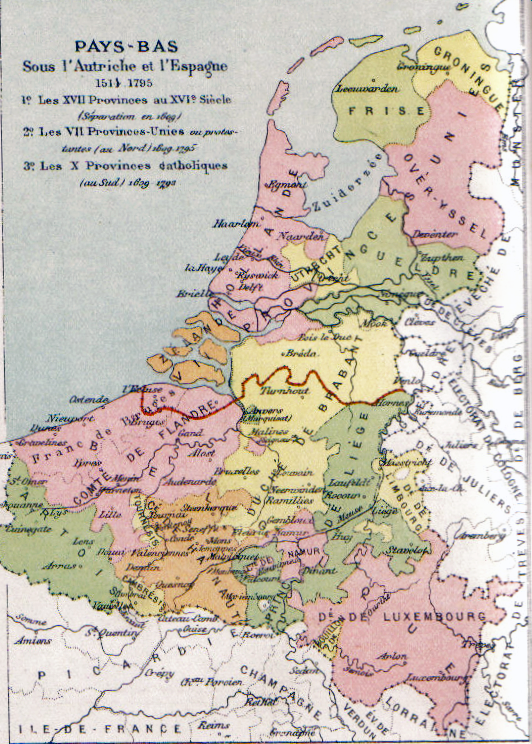
English: Map of the Habsburg Netherlands. Français : Carte des Pays-Bas des Habsbourg Nederlands: Map van de Habsburgse Nederlanden. |
||||||||||||||||||||
| Deiziad | Circa 1878 | ||||||||||||||||||||
| Mammenn | Scan from Atlas de géographie physique, politique et historique à l'usage de l'enseignement primaire et de l'enseignement moyen, Dessain, Liège, 35e éd., s.d., p. 40. | ||||||||||||||||||||
| Aozer |
|
||||||||||||||||||||

Aotre-implijout
|
This work is in the public domain in its country of origin and other countries and areas where the copyright term is the author's life plus 100 years or fewer. This work is in the public domain in the United States because it was published (or registered with the U.S. Copyright Office) before January 1, 1929. | |
| Rummet eo bet ar restr-mañ e-touez ar restroù hep strishadurioù implij anavezet evit ar pezh a sell ouzh ar gwirioù aozer, ha kement-se evit an holl wirioù kar ha stag. | |
| Annotations | This image is annotated: View the annotations at Commons |
Istor ar restr
Klikañ war un deiziad/eur da welet ar restr evel ma oa da neuze.
| Deiziad/Eur | Munud | Mentoù | Implijer | Notenn | |
|---|---|---|---|---|---|
| red | 25 Kzu 2009 da 00:32 | | 532 × 744 (813 Kio) | Paul2 | somewhat lighter colours |
| 24 Kzu 2009 da 22:53 |  | 532 × 744 (865 Kio) | Paul2 | Colours enhanced | |
| 31 Her 2005 da 11:12 |  | 532 × 744 (927 Kio) | BrightRaven | Map of the Spanish, then Austrian Netherlands. Author: MG Alexis |
Implij ar restr
Implijout a ra an 3 pajenn da heul ar restr-mañ :
Implij hollek ar restr
Ober a ra ar wikioù da-heul gant ar restr-mañ :
- Implij war ast.wikipedia.org
- Implij war be.wikipedia.org
- Implij war ca.wikipedia.org
- Implij war cs.wikipedia.org
- Implij war da.wikipedia.org
- Implij war de.wikipedia.org
- Implij war el.wikipedia.org
- Implij war en.wikipedia.org
- Implij war en.wikibooks.org
- Implij war eo.wikipedia.org
- Implij war et.wikipedia.org
- Implij war eu.wikipedia.org
- Implij war fa.wikipedia.org
- Implij war fr.wikipedia.org
- Histoire de la Belgique
- Histoire du Luxembourg
- Pays-Bas espagnols
- Gravelines
- Pays-Bas méridionaux
- Duché de Luxembourg
- Histoire de la Wallonie avant 1830
- Discussion:Duché de Luxembourg
- Territoires du royaume de France
- Juan d'Aguila
- Pays-Bas des Habsbourg
- Portail:Histoire militaire de la Belgique/Bac à sable
- Wikipédia:Statistiques des anecdotes de la page d'accueil/Visibilité des anecdotes (2018)
- Discussion:Duché de Luxembourg/LSV 15996
- Wikipédia:Statistiques des anecdotes de la page d'accueil/Visibilité des anecdotes (2018)/2018 10
- Projet:Aide et accueil/Twitter/Tweets/archives/octobre 2018
- Protestantisme aux Pays-Bas
- Wikipédia:Le saviez-vous ?/Archives/2018
- Utilisateur:Belysarius/brouillon1
- Discussion:Référendum luxembourgeois de 1919/LSV 21844
Gwelet muioc'h eus implij hollek ar restr-mañ.