
Restr:Congress Poland map 19th century.jpg
Restr orin (1 275 × 1 526 piksel, ment ar restr : 1,37 Mio, seurt MIME : image/jpeg)
![]()
| Tennet eo ar restr-mañ eus Wikimedia Commons ha gallout a ra bezañ implijet evit raktresoù all. Diskouezet eo deskrivadur he fajenn zeskrivañ amañ dindan. |
Diverradur
| Deskrivadur |
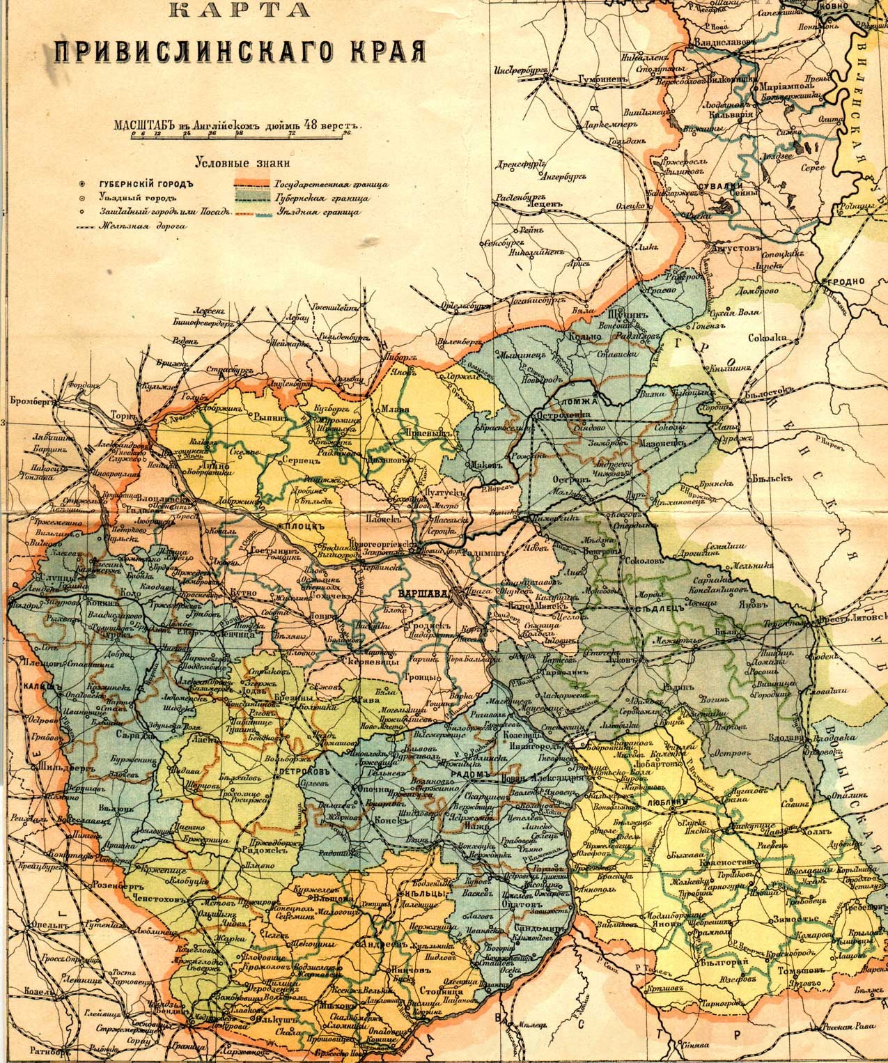
English: Russian map of Vistula land (Privislinsky Krai, former Congress Poland), approx. second half of the 19th century. The scale of the map is 48 versts per English inch. Left column of the legend:
Right column:
|
| Deiziad | |
| Mammenn | [1]/[2] |
| Aozer | |
| Aotre (Adimplij ar restr-mañ) |
Public Domain due to age |
| Stummoù all | File:Privisl.jpg |
![[1]](http://wojtek.onlinesc.net/bebelno/grafika/bebelno_mapa_polski_ii_pol_xix_w.jpg)
Aotre-implijout
|
This work is in the public domain in its country of origin and other countries and areas where the copyright term is the author's life plus 70 years or fewer.
| |
| Rummet eo bet ar restr-mañ e-touez ar restroù hep strishadurioù implij anavezet evit ar pezh a sell ouzh ar gwirioù aozer, ha kement-se evit an holl wirioù kar ha stag. | |
Istor ar restr
Klikañ war un deiziad/eur da welet ar restr evel ma oa da neuze.
| Deiziad/Eur | Munud | Mentoù | Implijer | Notenn | |
|---|---|---|---|---|---|
| red | 25 Kzu 2011 da 19:30 | | 1 275 × 1 526 (1,37 Mio) | Hic et nunc | removed watermark |
| 9 Gou 2007 da 19:28 |  | 1 275 × 1 526 (471 Kio) | Piotrus | {{Information |Description=Russian map of Poland, approx. second half of the 19th century. |Source=[http://wojtek.onlinesc.net/bebelno/grafika/bebelno_mapa_polski_ii_pol_xix_w.jpg]/[http://www.genealogia.ru/projects/maps/maps/map_privisl_jpg.htm] |Date=1 |
Implij ar restr
Implijout a ra ar bajenn da heul ar restr-mañ :
Implij hollek ar restr
Ober a ra ar wikioù da-heul gant ar restr-mañ :
- Implij war de.wikipedia.org
- Implij war hu.wikipedia.org
- Implij war pl.wikipedia.org
- Implij war pt.wikipedia.org
- Implij war ro.wikipedia.org
- Implij war www.wikidata.org