
Restr:Adıyaman districts.png
Restr orin (1 056 × 816 piksel, ment ar restr : 20 Kio, seurt MIME : image/png)
![]()
| Tennet eo ar restr-mañ eus Wikimedia Commons ha gallout a ra bezañ implijet evit raktresoù all. Diskouezet eo deskrivadur he fajenn zeskrivañ amañ dindan. |

|
This map has been uploaded by Electionworld from en.wikipedia.org to enable the |
Diverradur
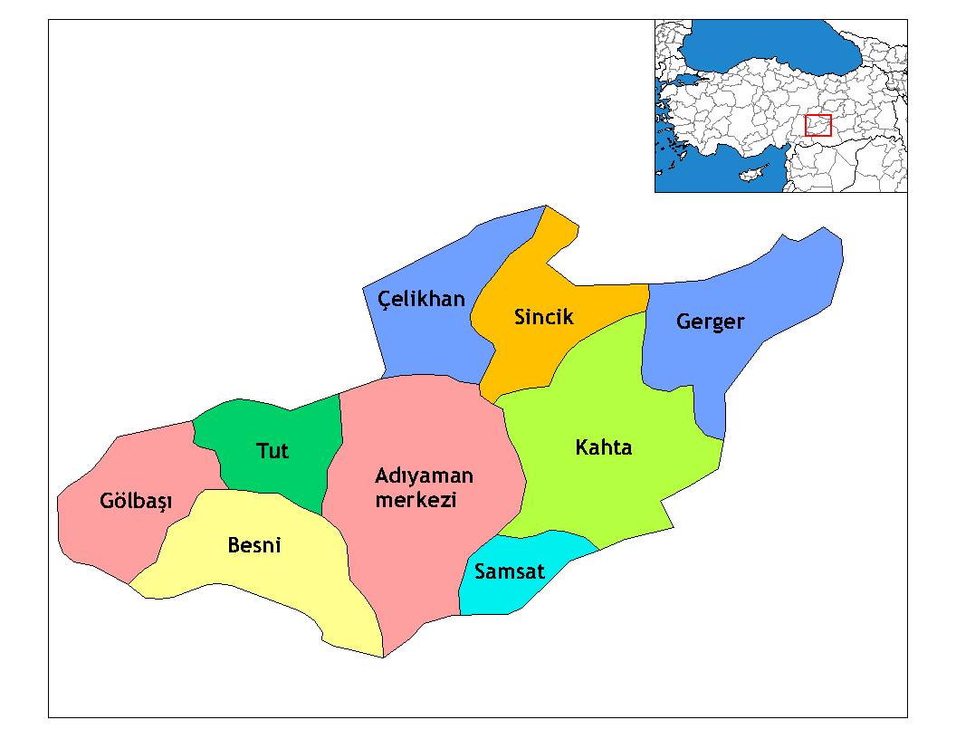
Map of the districts of Adıyaman province in Turkey. Created by Rarelibra 22:15, 13 November 2006 (UTC) for public domain use, using MapInfo Professional v8.5 and various mapping resources. Edited by One Homo Sapiens Corrected text where İ,Ş,ı,ğ,or ş occurs in name. Source: [statoids-com]. Increased font size and enhanced color differences among adjacent districts.

|
This locator map image could be re-created using vector graphics as an SVG file. This has several advantages; see Commons:Media for cleanup for more information. If an SVG form of this image is available, please upload it and afterwards replace this template with
{{vector version available|new image name}}.
It is recommended to name the SVG file “Adıyaman districts.svg”—then the template Vector version available (or Vva) does not need the new image name parameter. |
Aotre-implijout
| Lakaet eo bet an oberenn-mañ en domani foran gant e oberour, Rarelibra. Talvezout a ra kement-mañ evit ar bed a-bezh. E broioù zo e c'hall kement-mañ bezañ dibosupl ent lezennel; mard emañ kont evel-se : |
Renamed by Denizz
Istor ar restr
Klikañ war un deiziad/eur da welet ar restr evel ma oa da neuze.
| Deiziad/Eur | Munud | Mentoù | Implijer | Notenn | |
|---|---|---|---|---|---|
| red | 28 Kzu 2008 da 19:54 | | 1 056 × 816 (20 Kio) | One Homo Sapiens | Corrected text where İ,Ş,ı,ğ,or ş occurs in name. Source: [statoids-com]. Increased font size and enhanced color differences among adjacent districts. |
| 31 Meu 2007 da 05:14 |  | 1 056 × 816 (25 Kio) | Denizz~commonswiki | {{ew|en|Rarelibra}} == Summary == Map of the districts of Adana province in Turkey. Created by Rarelibra 22:15, 13 November 2006 (UTC) for public domain use, using MapInfo Professional v8.5 and various mapping resources. == Licensing = |
Implij ar restr
Implijout a ra ar bajenn da heul ar restr-mañ :
Implij hollek ar restr
Ober a ra ar wikioù da-heul gant ar restr-mañ :
- Implij war ast.wikipedia.org
- Implij war azb.wikipedia.org
- Implij war az.wikipedia.org
- Implij war bn.wikipedia.org
- Implij war ca.wikipedia.org
- Implij war cs.wikipedia.org
- Implij war de.wikipedia.org
- Implij war diq.wikipedia.org
- Aldûş
- Eskiköy
- Sarıyaprak
- Üçgöz
- Akpınar, Bêsni
- Aktepe
- Akyazı, Bêsni
- Alıçlı
- Alişar
- Aşağıçöplü
- Aşağısöğütlü
- Başlı
- Bereketli
- Beşkoz
- Çaykaya
- Çamuşçu
- Çamlıca
- Burunçayır
- Boncuk
- Beşyol
- Karagüveç
- Kuzevleri
- Oyratlı
- Tokar
- Qezê Tırkiya
- Çilboğaz, Bêsni
- Geçitli, Bêsni
- Kızılin, Bêsni
- Yelbastı, Bêsni
- Uzunkuyu, Bêsni
- Konuklu, Bêsni
- Gümüşlü, Bêsni
Gwelet muioc'h eus implij hollek ar restr-mañ.