
Restr:Karta över Sankt Petersburg på 1910-talet (ur Nordisk familjebok).jpg

Ment ar rakweled-mañ : 800 × 594 piksel. pizhderioù all : 320 × 238 piksel | 640 × 475 piksel | 1 024 × 760 piksel | 1 280 × 950 piksel | 2 560 × 1 901 piksel | 3 432 × 2 548 piksel.
Restr orin (3 432 × 2 548 piksel, ment ar restr : 2,2 Mio, seurt MIME : image/jpeg)
![]()
| Tennet eo ar restr-mañ eus Wikimedia Commons ha gallout a ra bezañ implijet evit raktresoù all. Diskouezet eo deskrivadur he fajenn zeskrivañ amañ dindan. |
Diverradur
| Deskrivadur |
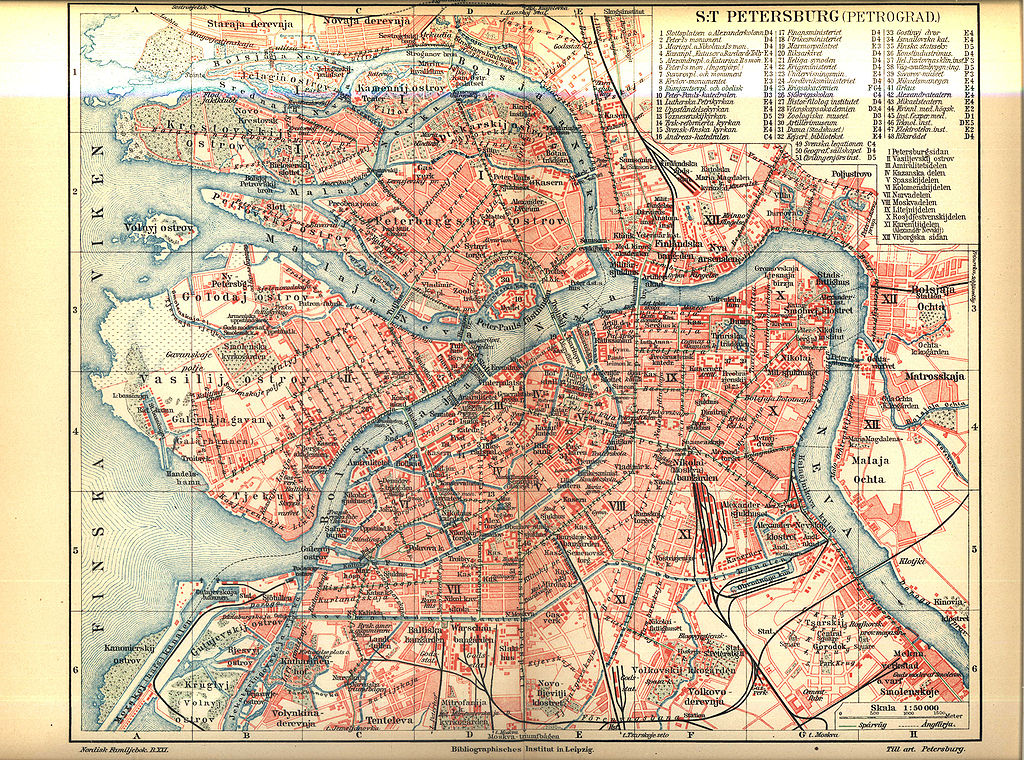
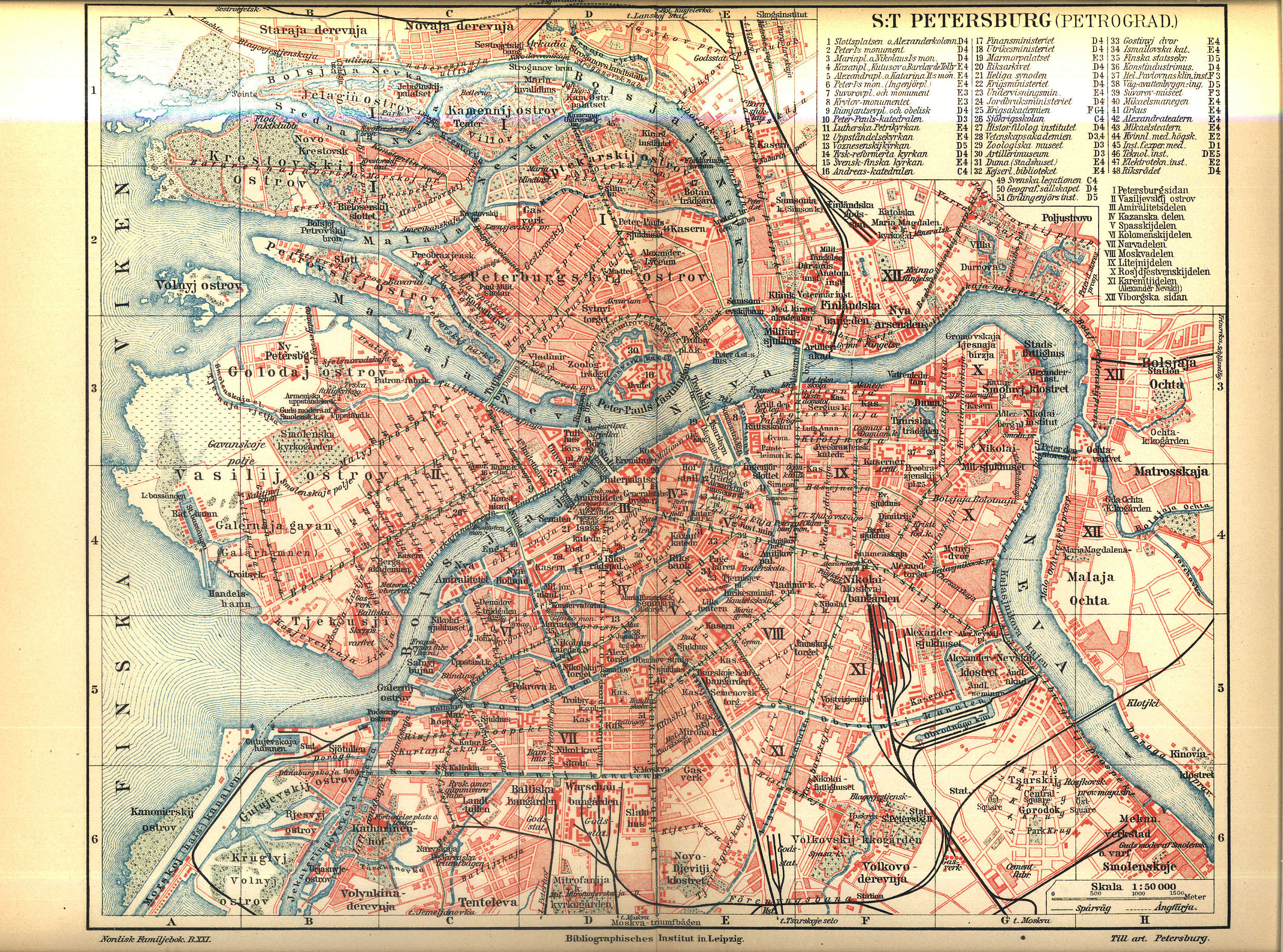
English: Map of Saint Petersburg between 1911 and 1915
Svenska: Karta över Sankt Petersburg på 1910-talet
Русский: Карта Санкт-Петербурга. Между 1911 и 1915. |
||||||||
| Deiziad | 1911 - 1915 (1911 - opened Peter the Great Bridge over Neva River; 1915 — published volume 21 «Papua - Posselt» of Nordisk familjebok) | ||||||||
| Mammenn | Nordisk familjebok | ||||||||
| Aozer |
English: Сonsociation "Prosveschenie", Saint Petersburg Русский: Товарищество "Просвещение", Санкт-Петербург |
||||||||
| Aotre (Adimplij ar restr-mañ) |
|
||||||||
| Stummoù all | spkarta.ru, |


.jpg)
| Open this image as an overlay in Google Earth (Google Maps, Bing) | (Help|Source) |
.jpg/overlay.kml)
Istor ar restr
Klikañ war un deiziad/eur da welet ar restr evel ma oa da neuze.
| Deiziad/Eur | Munud | Mentoù | Implijer | Notenn | |
|---|---|---|---|---|---|
| red | 26 Ebr 2005 da 22:09 | | 3 432 × 2 548 (2,2 Mio) | Den fjättrade ankan~commonswiki | *{{Svenska}} Karta över Sankt Petersburg på 1910-talet *{{English}} Map of Saint Petersburg at the 1910s *Source: Nordisk familjebok {{PD-Ugglan}} Category:Saint Petersburg, Russia Category:20th century maps |
Implij ar restr
Implijout a ra ar bajenn da heul ar restr-mañ :
Implij hollek ar restr
Ober a ra ar wikioù da-heul gant ar restr-mañ :
- Implij war es.wikipedia.org
- Implij war fi.wikipedia.org
- Implij war fr.wikipedia.org
- Implij war gl.wikipedia.org
- Implij war hy.wikipedia.org
- Implij war ja.wikipedia.org
- Implij war mn.wikipedia.org
- Implij war no.wikipedia.org
- Implij war ro.wikipedia.org
- Implij war sv.wikipedia.org
.jpg)