
Restr:Ethiopia shaded relief map 1999, CIA.jpg

Ment ar rakweled-mañ : 498 × 599 piksel. pizhderioù all : 199 × 240 piksel | 399 × 480 piksel | 1 010 × 1 215 piksel.
Restr orin (1 010 × 1 215 piksel, ment ar restr : 222 Kio, seurt MIME : image/jpeg)
![]()
| Tennet eo ar restr-mañ eus Wikimedia Commons ha gallout a ra bezañ implijet evit raktresoù all. Diskouezet eo deskrivadur he fajenn zeskrivañ amañ dindan. |
Diverradur
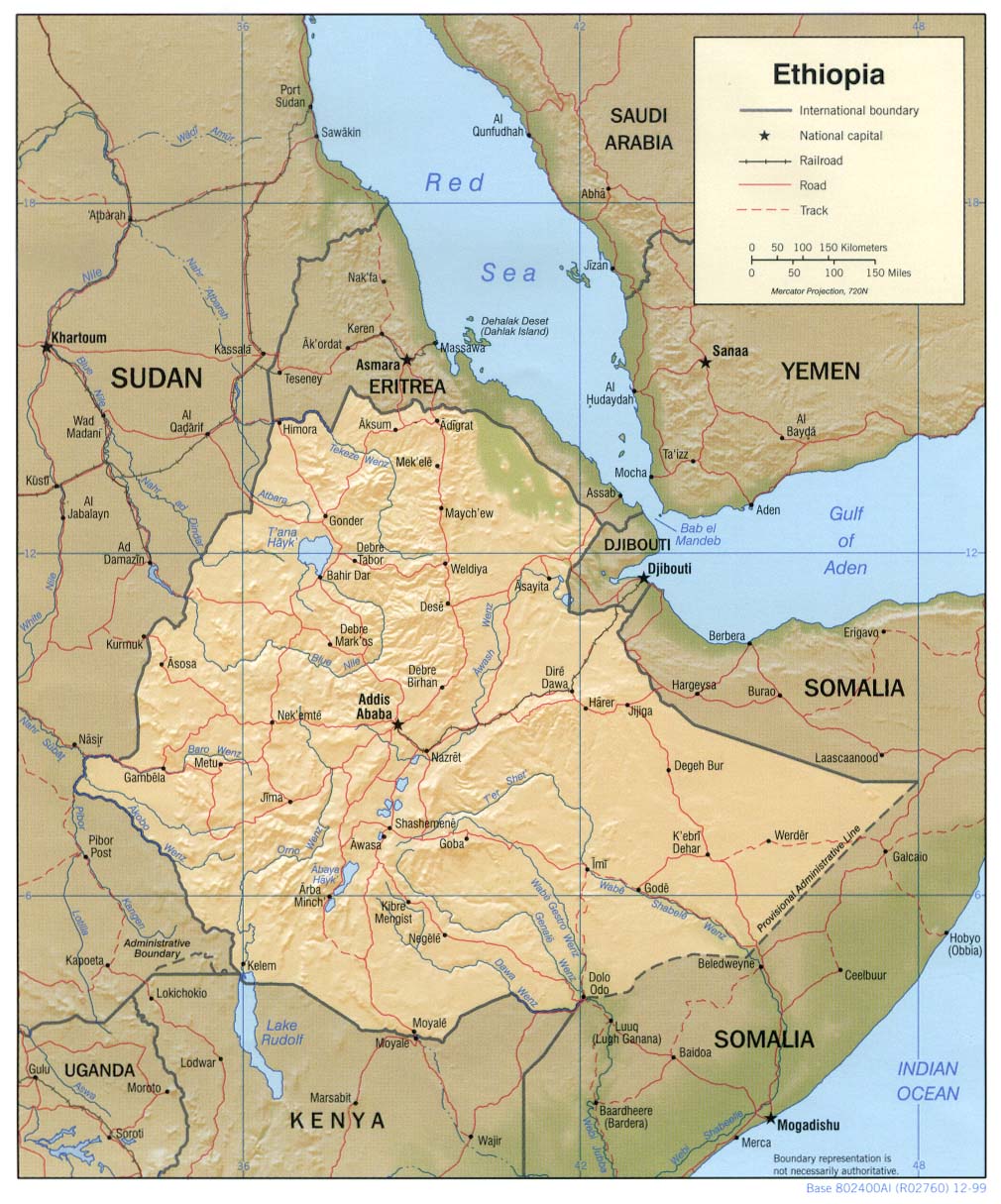
| Deskrivadur | Shaded relief map of Ethiopia, 1999, produced by the U.S. Central Intelligence Agency. |
| Deiziad | |
| Mammenn |
University of Texas Libraries, Perry-Castañeda Library Map Collection: Ethiopia Maps |
| Aozer | CIA |
| Stummoù all |
Derivative works of this file: |
Aotre-implijout
| This image is a work of a Central Intelligence Agency employee, taken or made as part of that person's official duties. As a Work of the United States Government, this image or media is in the public domain in the United States.
|

|
Istor ar restr
Klikañ war un deiziad/eur da welet ar restr evel ma oa da neuze.
| Deiziad/Eur | Munud | Mentoù | Implijer | Notenn | |
|---|---|---|---|---|---|
| red | 22 C'hwe 2006 da 11:23 | | 1 010 × 1 215 (222 Kio) | Lupo | Shaded relief map of Ethiopia. Source: [http://www.lib.utexas.edu/maps/africa/ethiopia_rel99.jpg] from the [http://www.lib.utexas.edu/maps/ethiopia.html Perry-Castañeda Library Map Collection]. {{PD-USGov-CIA}} Category:Maps of Cameroon |
Implij ar restr
Implijout a ra ar bajenn da heul ar restr-mañ :
Implij hollek ar restr
Ober a ra ar wikioù da-heul gant ar restr-mañ :
- Implij war ar.wikipedia.org
- Implij war ast.wikipedia.org
- Implij war av.wikipedia.org
- Implij war ba.wikipedia.org
- Implij war bg.wikipedia.org
- Implij war bs.wikipedia.org
- Implij war ca.wikipedia.org
- Implij war ckb.wikipedia.org
- Implij war cs.wikipedia.org
- Implij war da.wikipedia.org
- Implij war de.wikinews.org
- Implij war el.wikipedia.org
- Implij war en.wikipedia.org
- Implij war fa.wikipedia.org
- Implij war fr.wikipedia.org
- Implij war gcr.wikipedia.org
- Implij war he.wikipedia.org
- Implij war he.wiktionary.org
- Implij war hr.wiktionary.org
- Implij war id.wikipedia.org
- Implij war io.wikipedia.org
- Implij war it.wikipedia.org
- Implij war jv.wikipedia.org
- Implij war ka.wikipedia.org
- Implij war ku.wikipedia.org
- Implij war la.wikipedia.org
- Implij war ml.wikipedia.org
- Implij war mzn.wikipedia.org
- Implij war nl.wikipedia.org
- Implij war no.wikipedia.org
- Implij war os.wikipedia.org
- Implij war pl.wikipedia.org
Gwelet muioc'h eus implij hollek ar restr-mañ.