
Restr:Brittain 410.jpg
Restr orin (1 111 × 1 497 piksel, ment ar restr : 369 Kio, seurt MIME : image/jpeg)
![]()
| Tennet eo ar restr-mañ eus Wikimedia Commons ha gallout a ra bezañ implijet evit raktresoù all. Diskouezet eo deskrivadur he fajenn zeskrivañ amañ dindan. |
Diverradur
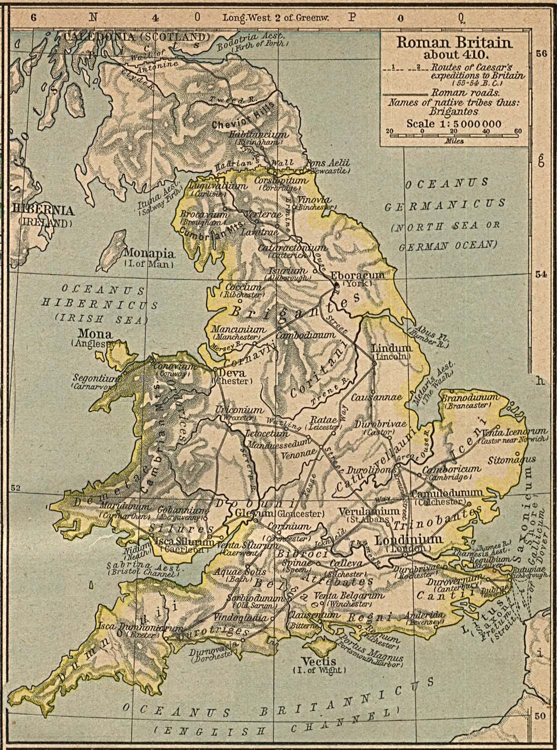
Map of the isle Great Britain in the year 410. Image comes from the Historical Maps of Europe at University of Texas at Austin The work is from From The Historical Atlas by William R. Shepherd, 1926.
Map is released into the public Domain.
Aotre-implijout
|
This work is in the public domain in its country of origin and other countries and areas where the copyright term is the author's life plus 70 years or fewer.
| |
| Rummet eo bet ar restr-mañ e-touez ar restroù hep strishadurioù implij anavezet evit ar pezh a sell ouzh ar gwirioù aozer, ha kement-se evit an holl wirioù kar ha stag. | |
Istor ar restr
Klikañ war un deiziad/eur da welet ar restr evel ma oa da neuze.
| Deiziad/Eur | Munud | Mentoù | Implijer | Notenn | |
|---|---|---|---|---|---|
| red | 3 Kzu 2005 da 15:24 | | 1 111 × 1 497 (369 Kio) | Migdejong | Map of the isle Great Brittain in the year 410. Image comes from the University of Texas at Austin: http://geography.about.com/gi/dynamic/offsite.htm?site=http://www.lib.utexas.edu/maps/historical/history%5Feurope.html Map is released into the publi |
Implij ar restr
Implijout a ra ar bajenn da heul ar restr-mañ :
Implij hollek ar restr
Ober a ra ar wikioù da-heul gant ar restr-mañ :
- Implij war ar.wikipedia.org
- Implij war arz.wikipedia.org
- Implij war azb.wikipedia.org
- Implij war bn.wikipedia.org
- Implij war ca.wikipedia.org
- Implij war cy.wikipedia.org
- Implij war el.wikipedia.org
- Implij war en.wikipedia.org
- Implij war es.wikipedia.org
- Implij war et.wikipedia.org
- Implij war fr.wikipedia.org
- Implij war hr.wikipedia.org
- Implij war hu.wikipedia.org
- Implij war hy.wikipedia.org
- Implij war is.wikipedia.org
- Implij war it.wikipedia.org
- Implij war lt.wikipedia.org
- Implij war pl.wikipedia.org
- Implij war ru.wikipedia.org
- Implij war sh.wikipedia.org
- Implij war sl.wikipedia.org
- Implij war sr.wikipedia.org
- Implij war zh.wikipedia.org