
Restr:Azores CIA.jpg

Ment ar rakweled-mañ : 800 × 539 piksel. pizhderioù all : 320 × 216 piksel | 640 × 431 piksel | 1 024 × 690 piksel | 1 433 × 966 piksel.
Restr orin (1 433 × 966 piksel, ment ar restr : 125 Kio, seurt MIME : image/jpeg)
![]()
| Tennet eo ar restr-mañ eus Wikimedia Commons ha gallout a ra bezañ implijet evit raktresoù all. Diskouezet eo deskrivadur he fajenn zeskrivañ amañ dindan. |
Diverradur


Aotre-implijout
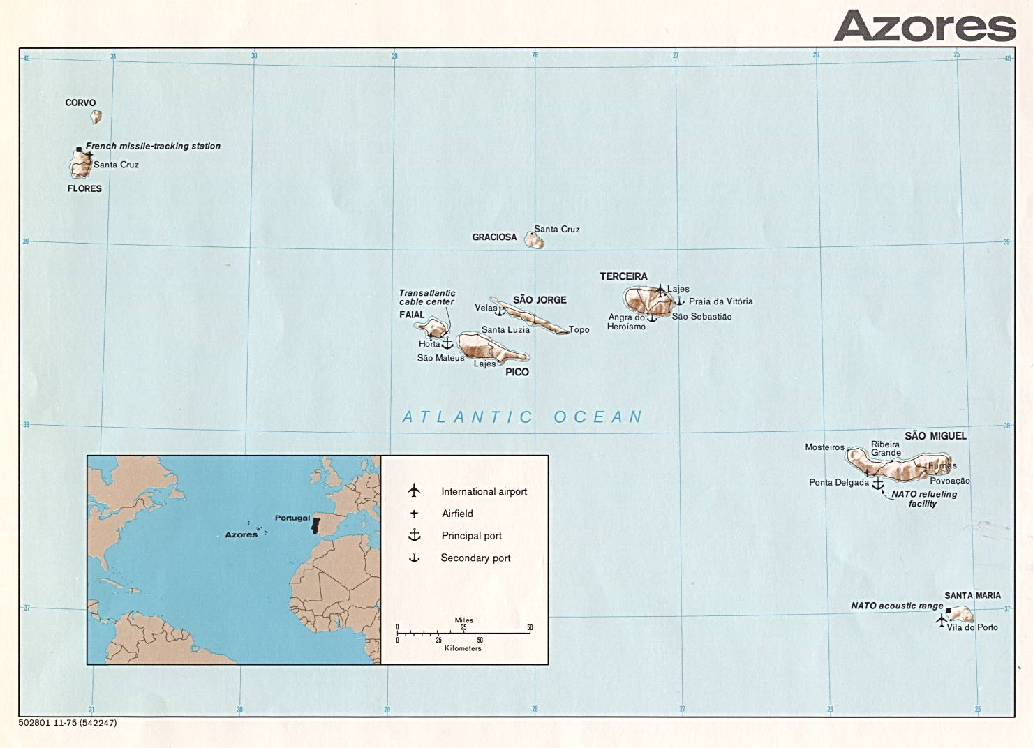
This map is part of this list of Europe maps from the Perry-Castañeda Library (PCL) of the University of Texas at Austin which are said to have been produced by the Central Intelligence Agency unless otherwise indicated.
| This image is a work of a Central Intelligence Agency employee, taken or made as part of that person's official duties. As a Work of the United States Government, this image or media is in the public domain in the United States.
|

|
Istor ar restr
Klikañ war un deiziad/eur da welet ar restr evel ma oa da neuze.
| Deiziad/Eur | Munud | Mentoù | Implijer | Notenn | |
|---|---|---|---|---|---|
| red | 20 C'hwe 2014 da 17:39 | | 1 433 × 966 (125 Kio) | Capmo | margins cropped |
| 24 Ebr 2006 da 12:28 |  | 1 480 × 1 072 (142 Kio) | Islandspec~commonswiki | ||
| 5 Meu 2006 da 17:43 |  | 1 480 × 1 072 (142 Kio) | Brian Boru | {{PD-PCL|azores.jpg|islands_oceans_poles/}} Category:Maps of Azores |
Implij ar restr
Implijout a ra an 2 pajenn da heul ar restr-mañ :
Implij hollek ar restr
Ober a ra ar wikioù da-heul gant ar restr-mañ :
- Implij war az.wikipedia.org
- Implij war en.wikipedia.org
- Implij war eo.wikipedia.org
- Implij war fi.wikipedia.org
- Implij war fr.wiktionary.org
- Implij war kk.wikipedia.org
- Implij war mk.wikipedia.org
- Implij war nl.wikipedia.org
- Implij war pt.wikipedia.org
- Implij war rue.wikipedia.org
- Implij war ru.wikipedia.org
- Implij war uk.wikipedia.org
- Implij war www.wikidata.org